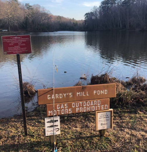
A public boat ramp is closed, a state road is shut down, and the Virginia Department of Wildlife Resources (DWR) is scrambling to contain a breach of the dam at Gardy’s Millpond.
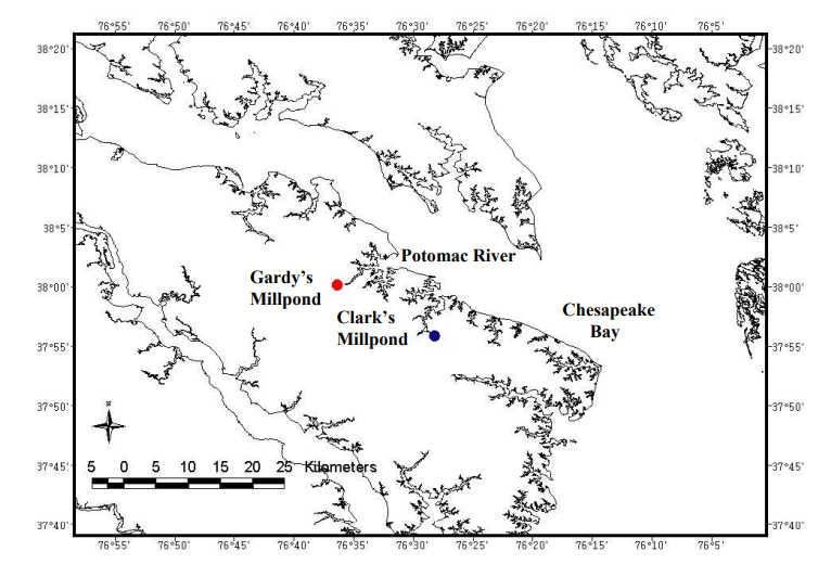
The pond, at the headwaters of the Yeocomico River feeding into the Potomac River, is a popular fishing spot with a boat ramp and pier. Anglers find success here with largemouth bass, bluegill, and redear sunfish.
On Saturday, May 10, the Virginia Department of Transportation discovered a possible breach of the Gardy’s Millpond Dam. Route 617 (Gardy’s Mill Road) was closed to vehicle and pedestrian traffic. An emergency spillway on the dam was quickly eroding, and DWR began efforts to lower the upstream reservoir surface elevation to limit further damage.
By Sunday, May 11, DWR issued emergency declarations for the “imminent failure” of the dam. DWR is urging the public to stay clear and not to recreate on the water. DWR contractors have begun emergency stabilization of the dam, including sandbags placed around the eroded portion. They aim to reduce further damage to the dam itself and to protect infrastructure in the area.
Gardy’s Millpond was once the property of the Gardy family, who operated a gristmill there until 1948. Its previous dam was breached in 1985, during Hurricane Bob. It was rebuilt and the 75-acre reservoir was stocked with fish, with public fishing reopening in 1990.
The DWR website says of its fishing opportunities, “If you’re looking to get away from it all and find a quiet spot to fish, this is it. The shallow nature of the pond allows for extensive cover of lily pads along the shoreline and the shallow flats.”
The dam itself is 450 feet long and 10 feet high. It is considered a “low hazard” dam, meaning that if it fails, there would be no expected loss of life or significant economic damage. It was last inspected in Sept. 2024, according to DWR.
Route 617, which passes along the embankment crest and over two spillways, will remain closed until detailed engineering assessments are finished. DWR’s emergency declaration remains in effect and there’s no estimate of when the road or boat ramp will be reopened. Crew will have to work quickly to stabilize the dam because heavy rains are anticipated to continue over the next few days.