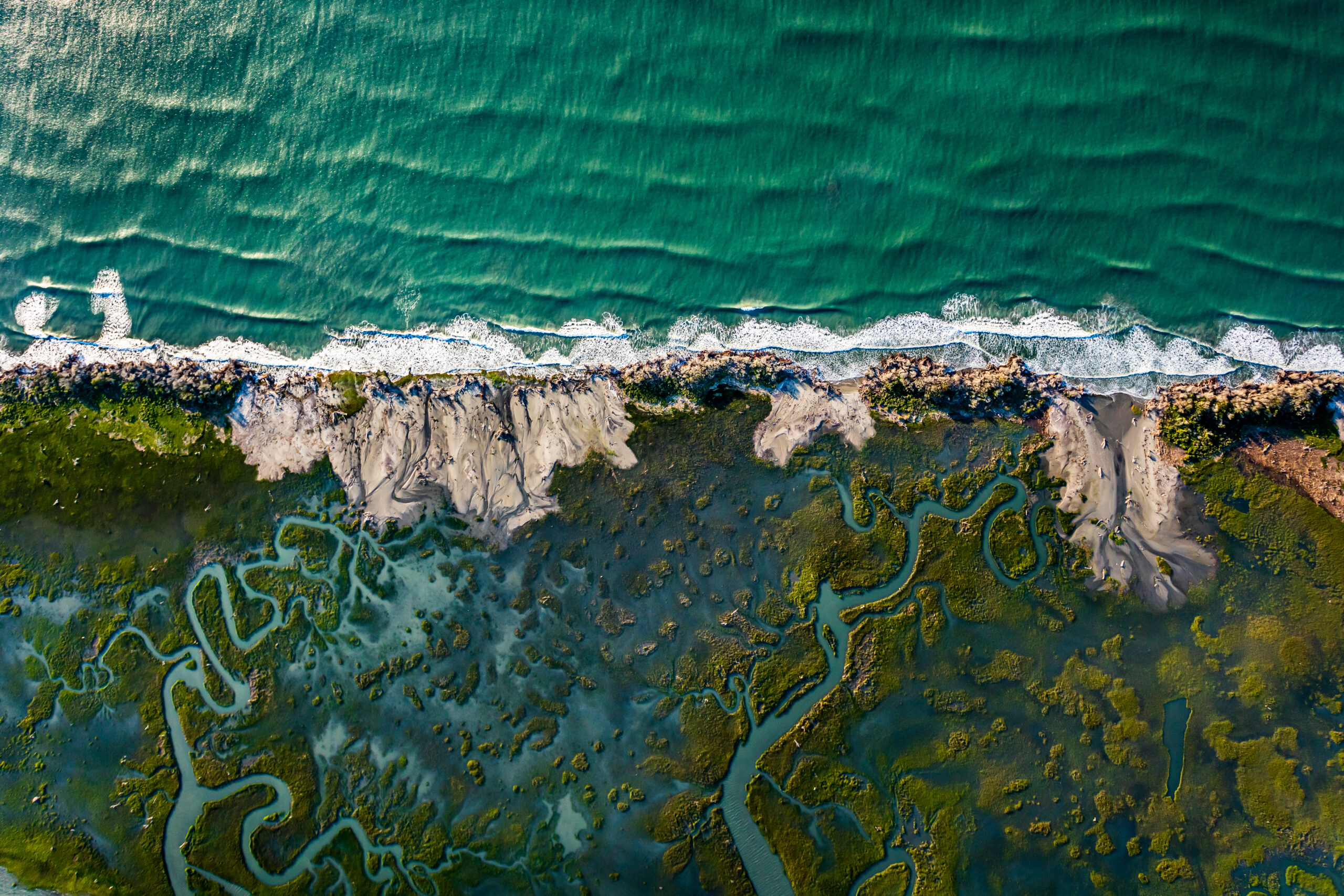
A summer sunrise, bright as polished copper, illuminates the barrier islands and lagoons of Virginia’s Eastern Shore. This treasured island landscape needs no burnishing. It’s an 80-mile-long East Coast anomaly: a stretch of deserted beaches, windswept dunes and salt marshes laced with impossibly circuitous channels, all nestled between two mega resorts, Ocean City and Virginia Beach.
From the air, the Atlantic seaboard’s lengthiest coastal wilderness reveals its past and prophesies its future. Building-less chimneys, pilings shorn of wharves and the rotting ribs of doomed ships indicate people once lived on and worked the seaward islands shielding the southern Delmarva Peninsula. Quirky inlets, deceptive shoals and sandy beaches that swallow dying trees bear witness to the sea’s constant remodeling of these westward migrating strips of sand and saltmarsh.
“It’s just such a unique place—the ruralness of the islands and the rawness of them,” says Gordon Campbell, an aerial photographer whose low-altitude images capture the shore’s stark beauty and abundant bird life. He’s photographed the East Coast and found no rival. “Maybe parts of the Georgia coastline, but this is the only area with a long stretch of just nothing.”
On coastlines, too, there are tipping points; moments when incremental changes suddenly become irreversible and there remains only “before” and “after.” On August 22, 1933, a hurricane spinning south of Virginia’s then-inhabited barrier islands foretold their destiny. For more than 30 agonizing hours, torrential rain and terrible winds swept away buildings and livestock, left residents clinging to treetops and battered hapless ships at sea with waves taller than palm trees.
The rain eventually stopped. The winds ceased their assault. But nothing on these ethereal islands would be quite the same.
The people—watermen, farmers, hoteliers and their guests—abandoned lives and livelihoods they’d pursued for generations. After enduring decade upon decade of hurricanes, nor’easters and ceaseless erosion, enough was enough. Rebuilding again was unthinkable.
The resilient islands recovered as they always have—at nature’s pace. Waterbirds—avidly hunted for food, sport and ladies’ millinery—returned, joining countless species that migrate along the Atlantic Flyway. Some wax myrtles, cedar and pine trees survived the storm’s power washing, preserving swaths of precious forest. Oysters, clams and bay scallops were buried in sand and stripped of nurturing grass beds. Their comeback was painfully slow.
There are maybe 20 seaside islands extending from the Maryland-Virginia border south to the mouth of Chesapeake Bay. Exact numbers depend on one’s definition of an island; some are mere marshy mounds protruding from shallow water at low tide, others are phantoms of the ocean.
Wind and waves conjure the barriers. What the sea takes it often gives back, shuffling sand to reshape islands or make them disappear and reappear. The southern end of Cobb Island, one of the narrowest, survived for decades as a summer resort because sea and wind kept extending its lease, replenishing with imported sand an oceanfront so firm it was said you could drive a carriage on it. Time expired for the Cobb Island resort in 1896, when storm waters over-washed the entire island and left the hotel half-buried by its former beach.
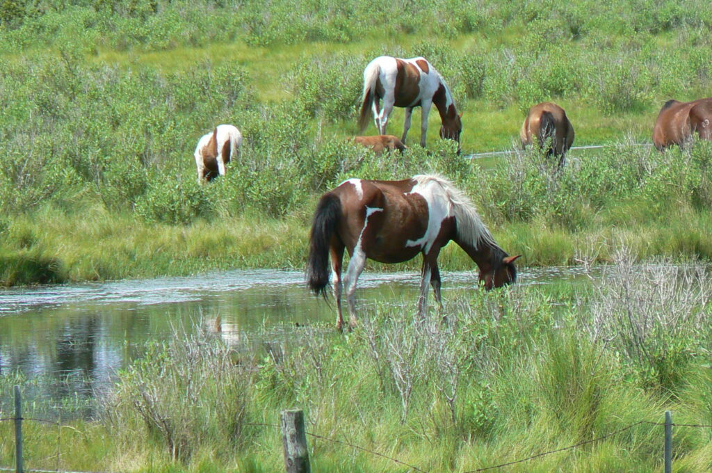
Today only the northern islands, Assateague, Chincoteague and Wallops, have significant human presence; Assateague as a national wildlife refuge and seashore, Chincoteague a watermen’s community-turned-tourist mecca, and Wallops a colonial-era livestock pasture-turned-naval-air-station-turned-launch site for NASA spacecraft. (The cattle would be gobsmacked by their old grazing grounds.)
But most islands appear nearly as untamed in the 21st century as they did when Captain John Smith explored one of the southernmost in 1608. The Nature Conservancy, a resourceful national conservation group, stepped in to acquire and protect 14 barrier and marsh islands, known collectively as the Virginia Coast Reserve, before developers could build on them. Meanwhile, an equally resourceful local group, founders of a museum and heritage site called the Barrier Island Center, is ensuring that the legacy of those who once lived here is never forgotten.
‘Like a Little Eden’
Humans once thrived on the middle and southern islands, too: in hotels and hunting lodges, life-saving stations and lighthouses, cottages for watermen and schools for their children. There was industry: boatbuilding, commercial fishing, shellfish shucking, sheep shearing and salt making to name a few. Hog Island had a town (Broadwater) of several hundred people, a post office, a couple general stores, an elementary school and a church.
The Great August Storm of 1933 submerged all but the largest of the islands, driving even the most stubborn residents to the mainland by the 1940s. The diaspora threatened their cultural heritage, too.
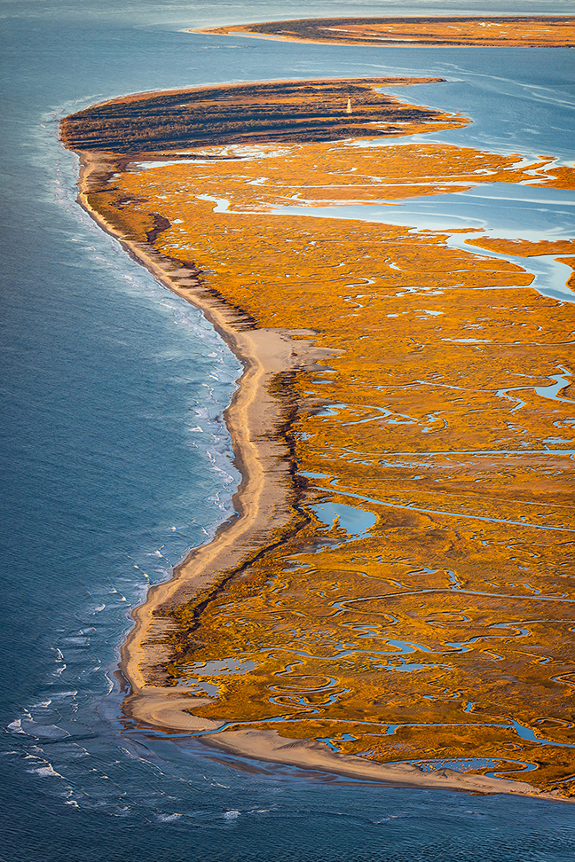
Photo by Gordon Campbell
Thelma Jarvis Peterson bought three vintage quilts from an elderly ex-Hog Islander 30 years ago and had a reckoning. Peterson traces her ancestry back to the 17th century on both the salty (the Jesters of Assateague and Chincoteague) and brackish (the Jarvises of the Chesapeake) sides of the peninsula. She learned that many more of the old woman’s possessions had been sold to a collector living 200 miles away. Worse still, they weren’t the first island artifacts to go.
“At her house that day it really hit me that a huge part of our history, our heritage, was gone,” Peterson recalls. “I left feeling depleted, angry and upset.” Her emotions percolated for a few days before she consulted a friend, Chincoteague museum curator John Maddox. With his encouragement, she gathered more than 20 prominent citizens into a steering committee that raised funds and civic awareness. Their ultimate mission was to create a museum that would preserve island artifacts and teach island heritage.
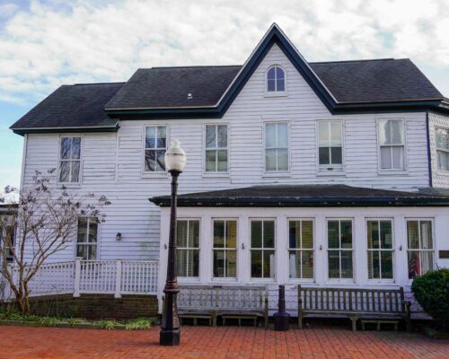
Housed in a renovated, 19th-century county almshouse, the Barrier Island Center sits at the end of a winding, crepe myrtle-lined driveway not far from U.S. 13 in Machipongo. The building (called the “poorhouse” in its day) is rich in island lore. More than 7,000 artifacts—nearly all of them donated or on long-term loan—fill two floors and an attic: islanders’ spinning wheels, rocking chairs and toy sailboats; decoys, shotguns and furnishings from numerous hunting lodges; room keys, a front desk ledger and a restored harp from the celebrated Cobb’s Island Hotel; a breeches buoy, logbook and uniforms from the islands’ U.S. Life-Saving Service and Coast Guard stations; even the Sears & Roebuck bed on which a newlywed couple stood to escape floodwaters during 1933’s storm.
In a short film, Hog Island emigrants reminisce about their homeplace. “It’s like a little Eden,” a former Broadwater resident says (conceding that paradise was filled with outsized mosquitos and a biblical quota of snakes). Islanders were close-knit, self-sufficient, and celebrated July Fourth with a community picnic, a baseball game and homemade pies. “It was a way of life that you can never reclaim,” he says.
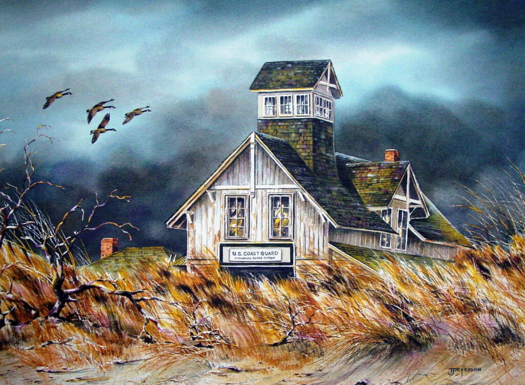
Peterson, the center’s first board chairperson and director, has retired from her administrative roles and now pursues her other talents: painting and songwriting, with the local seascapes, culture and history as her inspiration. Photographer Campbell, who moved here 20 years ago to buy an old airstrip and now runs a gallery in Cape Charles, is one of the board’s current members. But Peterson has remained a chronicler of vanishing island history. When a client commissioned a watercolor of Cobb’s Island’s derelict 1880s life-saving station, she was inspired to make the work the basis for an eight-print series featuring abandoned stations.
“It took about 15 months to get out to all islands,” she says, “and 15 years until all the prints were done.” Today, only the Assateague and Cedar island stations remain. Peterson harbored a special affinity for Cobb’s, which was, as she puts it, “taking a bow” when she first saw it. “She held on well,” Peterson says of the structure, a watermen’s navigational landmark, which fell into the sea a little over a year ago.
Peterson devotes a song on her CD Of Salt and Sand to “the devil storm” of 1933, which forced even Coast Guardsmen to flee their posts. Three people died on the mainland and in the marshes, including a child ripped from her mother’s arms as they sheltered on a roof. Caretaker George Cobb was swept off the island his family had lived on for a century.
“The ocean’s in the attic,” Peterson sings of the peril facing islanders, among them a relative. “Aunt Lizzy and her daddy tied themselves to a tree/With a boat lashed to the trunk below,” the song goes. The pair survived. Most islanders disassembled their houses, took them by barge to mainland towns like Willis Wharf and Oyster and started new lives. Sixty years later, Peterson writes in “Storm of Thirty Three,” Aunt Lizzy went looking for the tree “that saved them from washing out to sea.” She found it; rope still embedded in its trunk.
‘Quietly Conserving Nature’
A naval bombing range, a cross-marsh causeway, a toll bridge and a multimillion-dollar seaside resort with vacation homes, hotels, an airport and an amusement pier. One or all of those could have been the barrier islands’ fate had no one raised objections.
The first alarm was sounded in 1955 when it was reported that the U.S. Navy wanted Parramore Island for target practice. Midway down the chain, Parramore was and still is considered the crown jewel of barrier islands; it’s the largest in the group and supports the only old-growth maritime forest.
The island’s then-owner connected with The Nature Conservancy, a fledgling non-profit based in Northern Virginia. Could they help scuttle the Navy’s plans and make Parramore a wildlife refuge? It took decades for the Conservancy to secure the island, but the Navy eventually backed down.
The completion in 1964 of the Chesapeake Bay Bridge-Tunnel and, three years later, a proposed causeway linking privately owned Cedar Island to Parramore and points south, threatened to open multiple islands to development. The U.S. Army Corps of Engineers surveyed them all and concluded that the “barrier islands should not be developed for residential purposes or even expensive summer cottages.” Its 1968 report was bluntly dismissive of would-be developers and their assurances: “As a rule, such people know little or nothing about the forces of erosion at work.”
Developers weren’t deterred. In 1969, the Smith Island Development Corporation unveiled plans for a massive residential-commercial resort on the southern islands of Smith, Ship Shoal and Myrtle. When a recession stalled the project, The Nature Conservancy was able to acquire the islands, thanks—ironically—to the philanthropy of a woman whose grandfather developed much of coastal Florida. The Mary Flagler Cary Charitable Trust largely underwrote a Conservancy land-buying spree that secured not only 14 islands, but mainland buffers, too, including farms and marshland whose use could imperil the islands. The Conservancy is now the largest landowner on Virginia’s Eastern Shore, although, the group hastens to point out, a neighborly one.
“Ninety percent of the islands we own allow public use,” explains Jill Bieri, director of what’s officially known as the Volgenau Virginia Coast Reserve (VVCR). She’s spent nine years with The Nature Conservancy and more than 30 as a marine scientist and environmental educator. “This is kind of like a dream job,” she says. Bieri oversees a staff of 12 at VVCR’s headquarters, a low-slung, shingle-sided building on Brownsville Preserve, a 1,200-acre former tobacco farm in Nassawadox.
The Coast Reserve functions as an environmental classroom and ecosystem laboratory. The University of Virginia and the College of William & Mary’s Virginia Institute of Marine Science maintain research facilities nearby, two of numerous scientific collaborations VVCR fosters. On beaches, salt marshes and coastal bays, biologists monitor migratory bird populations, work to restore marine habitats and study coastal resilience.
VVCR fosters budding scientists, too. Conservancy staff take local students on nature-immersive field trips. Fifth graders learn to identify animal tracks in the marshes. Seventh graders paddle kayaks through lagoons to examine oyster reefs. Tenth graders visit Parramore Island to study biodiversity. Conservancy staff also offer week-long professional development sessions to local teachers.
Without the bridges developers had sought, the islands are only accessible in the traditional way—by boat. Birding, beach walking, photography, paddling, surf fishing and other low impact day-use activities are permitted, although some islands close seasonally to protect nesting shorebirds and some, like Parramore, have privacy restrictions. Other islands are publicly accessible under the auspices of state and federal agencies.
The VVCR is one of about 700 global sites of excellence in UNESCO’s World Network of Biosphere Reserves (the United States has only 28). As such, its mission is part scientific, part public engagement: preserve an invaluable ecosystem in an environmentally sensitive yet culturally and economically acceptable manner. The latter had bumpy beginnings.
Residents whose families had hunted and trapped on the islands for generations saw no compelling reason to abandon the tradition. Early VVCR managers functioned as ersatz game wardens and reluctant caretakers of Hog Island’s feral sheep. (The wooly wanderers have since been removed.)
Bieri says public misunderstanding about VVCR’s financial obligations also required some fence-mending: “We do pay taxes on the land we own.” The organization conducted public focus groups six years ago and has a Community Advisory Committee whose members include (as of last summer) a farmer, a minister, an educator, ecotourism guides and a representative of the shore’s multimillion-dollar aquaculture industry.
VVCR staff leave politics at the door when engaging with the community. “We know not to say ‘climate change’,” Bieri says. Instead, they discuss with local leaders and residents ways to mitigate flooding and their other climatic concerns.
Meanwhile, Bieri says, “we’re quietly conserving nature.” Vital habitat has been restored: Eelgrass beds went from virtually zero acres to 10,000 (the world’s largest seagrass restoration project). Oysters were restored by planting shell and building reefs with artificial substrate. Bay scallops were reintroduced where they hadn’t lived in 80 years. Bird species whose populations plunged due to hunting and egg-collecting have rebounded. In 1907, a noted ornithologist predicted extinction for the islands’ gull-billed terns, royal terns and American oystercatchers. All three species are still there.
‘Like Buying a Piece of the Wind’
Broadwater lies under the ocean now. So do the sites of hotels and life-saving stations. The barrier islands are creeping landward at as much as 18 feet a year, a pace predicted to increase as sea level rises. The only reason many haven’t eroded completely is what lies on their landward side—saltmarsh.
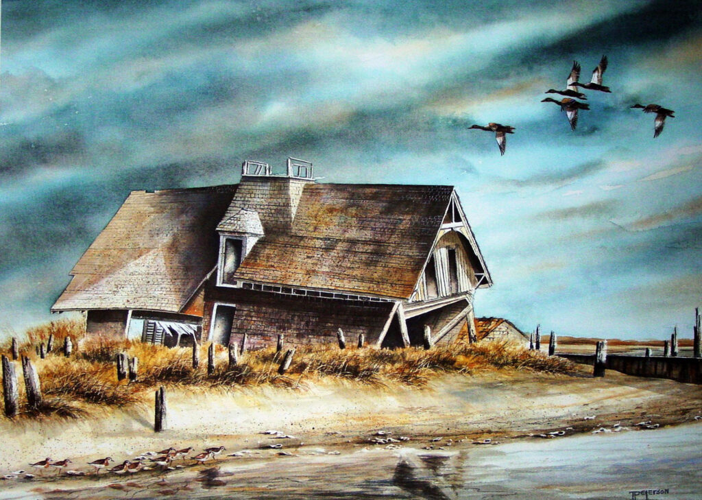
Painting by Thelma Peterson
The islands can retreat rather than surrender because marshes provide a foundation on which the islands rebuild using sand and silt shoveled inland by the sea. An observant Cobb’s Island visitor once likened the process to eating a banana: the sea gradually peels back beach, then dune, then ridge, up to the marsh’s edge—and devours it.
This is, of course, bad news for the marshes, the creatures who live there and mainland communities increasingly vulnerable to coastal storms, storm surge and tidal flooding. Wetlands naturally temper wave speed and height and researchers have calculated that coastal lagoons have lost almost 8,000 acres of protective saltmarsh (nearly four times the size of Cape Charles) since 1870.
Susan Bates, VVCR’s coastal science program manager, works with local communities to forecast climate vulnerabilities and propose natural infrastructure to mitigate them (oyster reefs and restored wetlands, for example). Using a web-based modeling tool customized for Virginia’s Eastern Shore, Bates can, for example, simulate flooding and even the movement of sand over time.
“For me, it’s where exciting science can come into play,” says Bates, who holds degrees in oceanography and climate dynamics. “I wanted my science to be relevant.”
Will conservation, education and climate science help preserve the Atlantic coast’s wildest place? Time and rising tides will tell. Until then, the barrier islands remain as restless and fickle as the sea they hold at bay.
“It’s like buying a piece of the wind,” an Eastern Shore waterman told the Washington Post after The Nature Conservancy acquired the Coast Reserve. “Those islands change all the time. Come a big storm and one of them can disappear between sundown and sunup.”
Maryland native and award-winning contributor Marty LeGrand writes about nature, the environment and Chesapeake history.