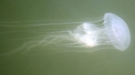
Many a Bay boater will choose to head north instead of south for a late-summer cruising weekend—in hopes of avoiding those unpleasant Chesapeake dwellers, jellyfish. Now, the National Oceanic and Atmospheric Administration (NOAA) is using its data on water temperature and salinity to predict how likely you are to hit sea nettle territory in each different part of the Bay and its tributaries.
Cheryl Costello explains what you can look for on any given day you head out on the water. Watch below:
Here’s the link with day-to-day Bay nettle probability: ocean.weather.gov/Loops/SeaNettles/prob/SeaNettles.php