The city of Norfolk, Virginia announced a new interactive flooding map last week—just in time for the “king tide”, the city’s highest predicted tide of the year.
The map, which contains multiple tools and overlays, allows city residents and visitors to learn more about flooding and the city’s plans for dealing with that flooding. The announcement is timely, because the king tide is forecasted for this weekend.
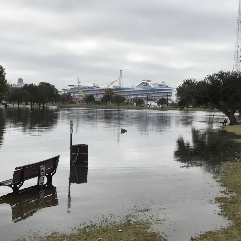
The king tide is actually called a Perigean-Spring Tide, which are the highest predicted tides during a year. King tides occur when the sun and moon are in alignment and the moon is closest to earth, so the moon’s gravity has a maximum effect on tides. The king tides for Norfolk are Friday October 27th through Sunday the 29th.
Wetlands Watch, a Norfolk-based non-profit, sends volunteers out each year to measure the king tides.
Volunteers use a free app that lets them record their observations of high water. According to the program website, “Our original goal was to collect data to improve flood modeling. We work in partnership with a number of data users, especially the Virginia Institute of Marine Science (VIMS) to help their work on their Storm Sense modeling effort. The idea for this app came from the realization that community members knew where the flooding occurred in their neighborhoods but getting that information collected was a challenge. Then we observed the crowdsourcing that sprung up after Hurricane Sandy and realized there was an opportunity to use smartphones and social media to involve the public more deeply in the process of adaptation.”
The Elizabeth River Project (ERP) will also be participating in the king tide evaluation. According to Marjorie Mayfield Jackson, Executive Director, “We are doing something very special with the king tide. We are launching a new program, Link Up, to link children from marginalized communities with mentors in the sciences—starting with mentors working on these community science programs!“
Through the program, 16 students will learn what the king tide is and how high tide flooding and stormwater runoff affect pollution in the river.
Meanwhile, the newly launched maps show not just Norfolk’s current flooding problems, but Norfolk’s future. The map tool displays some history, completed restoration projects, and ambitious future plans. They include a large flood wall that covers the entire mouth of the Lafayette River—from Tanner Point, part of Norfolk International Terminals, to the old landfill/golf course behind Old Dominion University. That section is over a mile. The wall would protect the entire Lafayette watershed from catastrophic flooding events, but would not be used to combat more frequent “nuisance flooding” events.
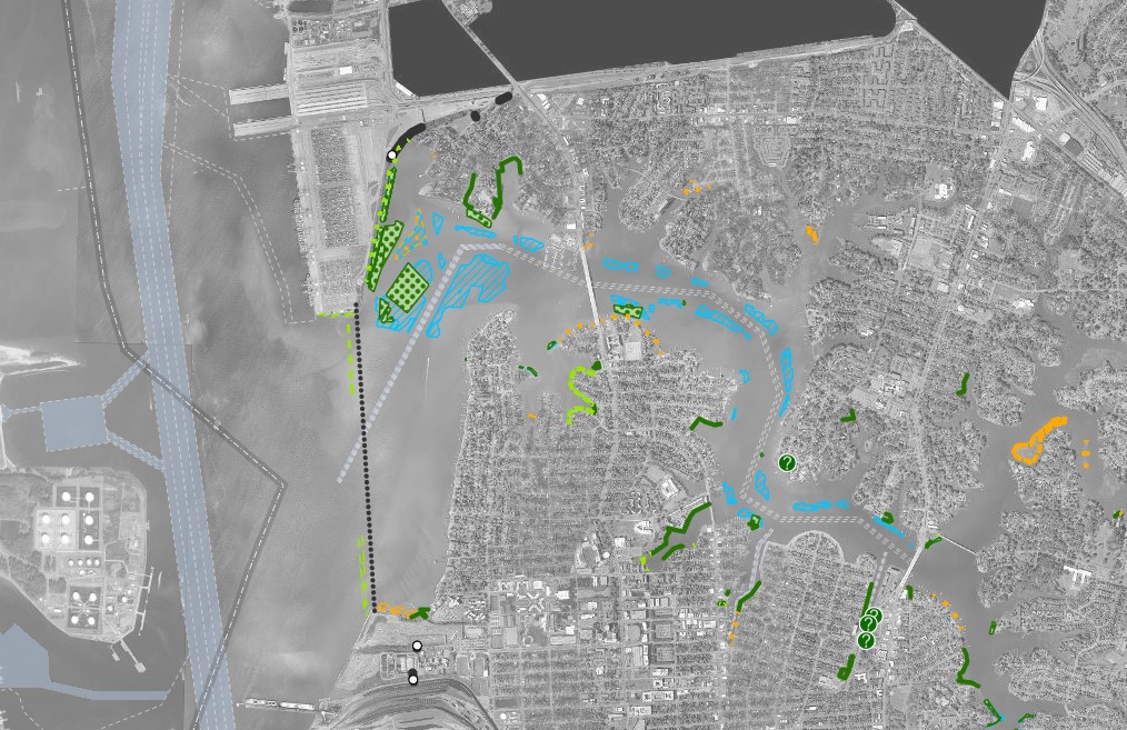
Another major wall will be under West Brambleton Avenue by the Hague. The Hague is what is left of Smith Creek, the area that is home to the Chrysler Museum as well as numerous other historic buildings and churches.
The flood wall design is clever: If a storm is approaching, the flood gates will be closed in advance at low tide. This will keep the storm surge out. The low water level inside the wall will give the rain someplace to go. Because so many storm drains in Norfolk flow directly into the watershed, rainwater has no place to go if seawater has backfilled and flooded the drains. Closing the gate at low tide solves that problem.
The interactive map includes a wealth of additional information for those that want to investigate. It can reveal floodplains and historical shorelines. You can see future plans in different neighborhoods. Projects are color coded to identify their priority level. It can take a little time to figure out all the layers and features.
You can find Norfolk’s interactive map here and get more information about the king tide here: wetlandswatch.org/catchtheking.
-Kendall Osborne