A guide to the best and fastest places to get off the Bay when you need to do it right this minute.
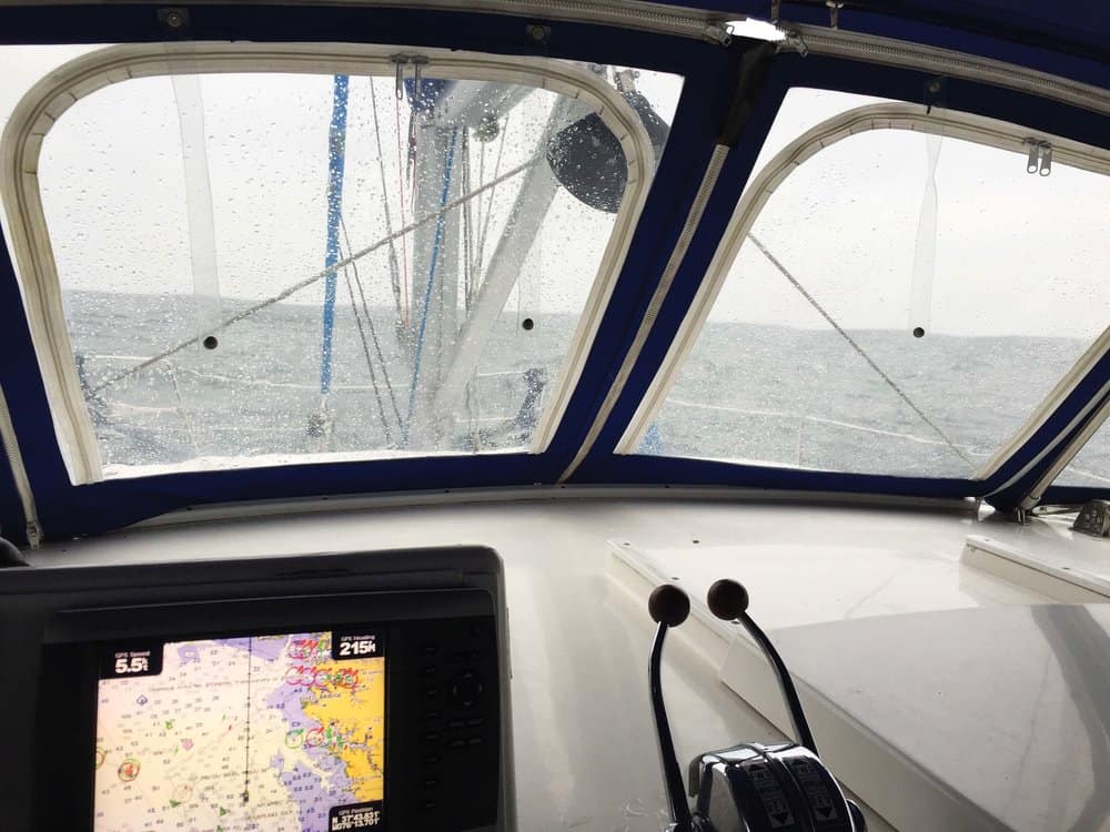
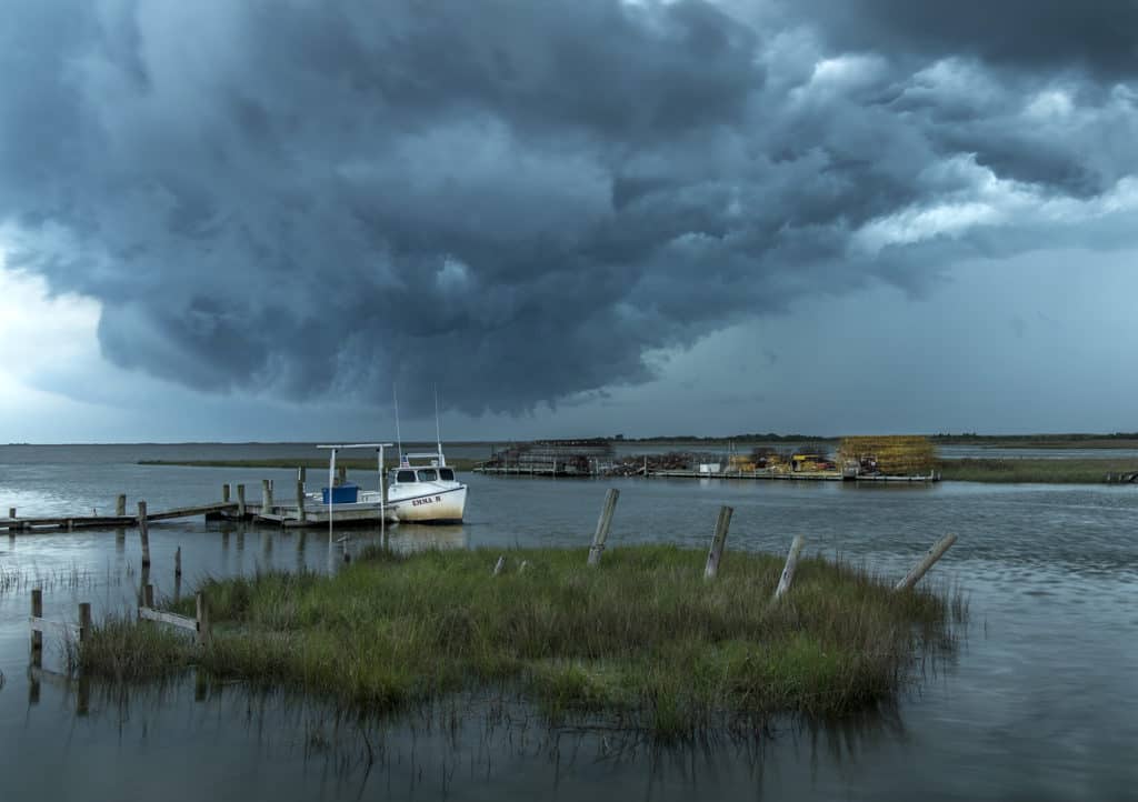
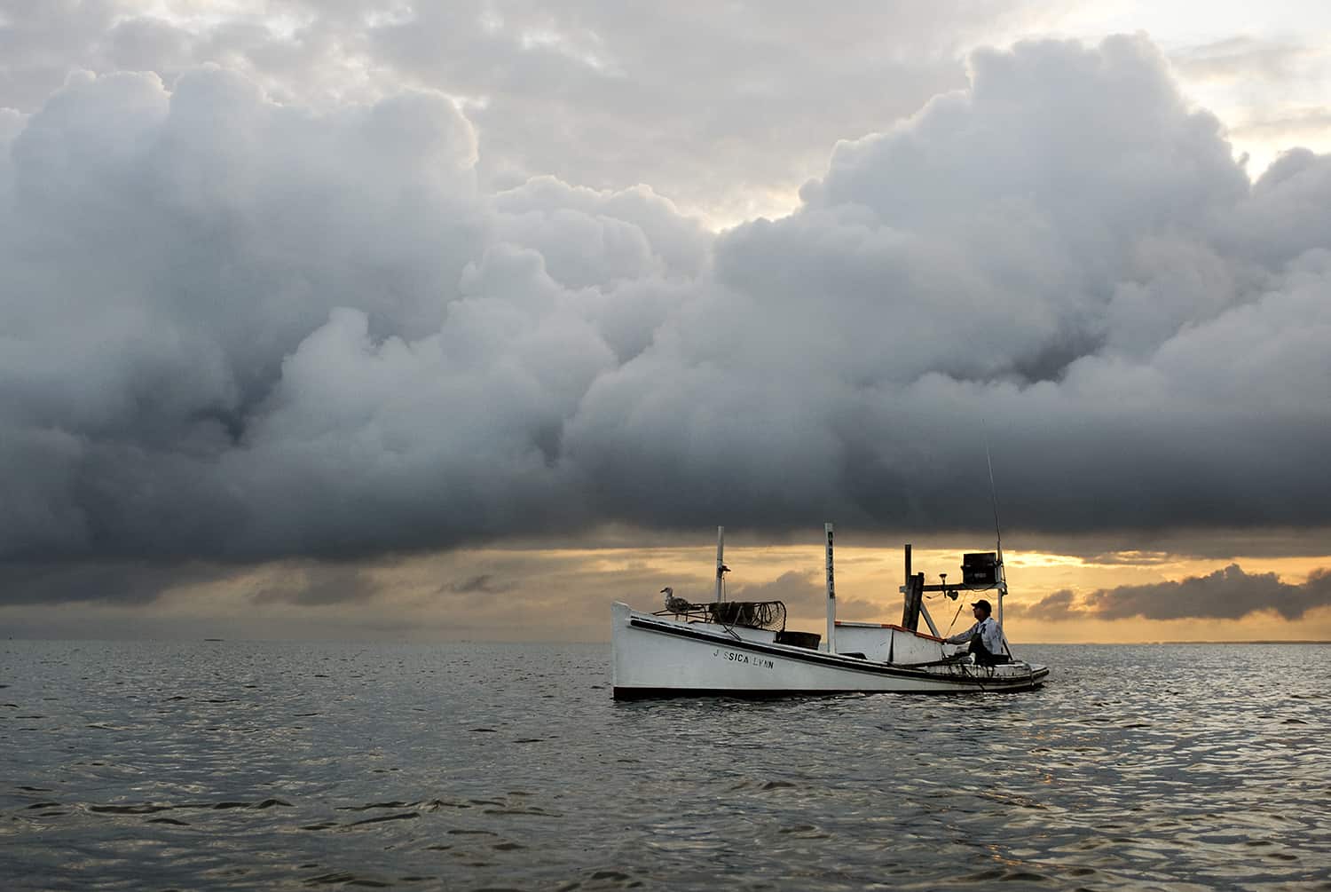
Imagine a bright summer day on the Bay on a fun family weekend. Suddenly, you notice a Manhattan skyline of cumulonimbus clouds on the horizon, the temperature begins to drop as the wind freshens and the weather goes belly up. You realize that you need to run for cover. But where? You check your position and pull out this handy guide to find the nearest sanctuary, and simply go there to ride out the squall. Just like that.
There are many shelter options on the Bay and dozens of them are not listed here because they are farther off the Bay and so not the best choices. This guide’s purpose is to give you the best places around the Bay to quickly take cover.
Maryland Storm Holes
ELK RIVER—Cabin John Creek,
2 ½ miles up the Elk, is the closest, but too shallow for deep-draft boats. Some claim five feet of water, but Capt. Jody has never found more than four feet. The best alternative is probably Veazey Cove, eight miles up from Turkey Point and just inside the Bohemia River on the southern shore. It is wide open to the north, however. If you are on the northern Bay and have a bit of time, choose the Sassafras River instead.
SASSAFRAS RIVER—If you are feeling brave, follow the charts to find the narrow entrance to well-protected Lloyd Creek, two miles upriver from Grove Neck on the south shore. Once in, sound carefully, because it shallows quickly. A better choice is Turner Creek, 3 ½ miles inside Grove Neck, also on the southern shore. The channel has a few interesting twists and turns, but if you follow the markers, you’ll find a charming county park, watermen’s dock and a small protected anchorage.
STILL POND AND CREEK—Just three miles below the mouth of the Sassafras, also along the Bay’s Eastern Shore, you’ll find Still Pond, and beyond it, through a narrow entrance, Still Creek. If the wind is from the northeast or southwest, you can anchor outside in the lee of the appropriate shore in eight or nine feet. For better protection, thread your way through the marked entrance to Still Creek. Here you’ll find a lovely protected area with plenty of room to anchor. It gets crowded on summer weekends, but in a storm, you won’t care.
WORTON CREEK—Another three miles below Still Pond, you’ll find Worton Creek. There is plenty of room and deep water outside the creek entrance, with north-south protection, but farther in, behind the spit of land, is a large bay with moored boats, several marinas and places to drop anchor. Well inside, opposite Worton Creek Marina, you’ll find six or seven feet nearly to the Western Shore. You’ll also find some supplies and a very nice restaurant at the marina.
HAWK COVE AND MIDDLE RIVER—For a quick Western Shore refuge, dive behind Hart-Miller Island, hugging either the southeast or west shore, as appropriate. You’ll find plenty of room in Hawk Cove and about eight feet or so. For long-term protection, continue into Middle River. Sue Creek, the first to port, has about seven feet inside but shallows to three or four very quickly. A better choice is Galloway Creek, though that is open to the south. Better yet, go on to Frog Mortar Creek, where you can choose an anchorage just off the channel at several points on the way up. Hawk Cove is about three miles off the Bay’s western channel, and Frog Mortar about six.
PATAPSCO RIVER—About nine miles south of Hart Miller Island on the Western Shore, you can make a beeline for Bodkin Creek, which lies on the south side of the mouth of the Patapsco River. It’s a handy place, though the channel is narrow and prone to a few shifting shoals to about six or seven feet on the way in. You can drop anchor just inside to port or continue up the main creek to a good anchorage in Jubb Cove or the next cove to starboard for better protection from northerlies.
SWAN CREEK—Ten miles south of Worton Creek you will find a lovely, protected anchorage at the top of Swan Creek, as well as several good marinas. The down side is that you will have to come 1 ½ to three miles south of the creek, depending on your draft, to avoid Swan Point Bar.
CHESTER RIVER— If you’ve already passed Swan Creek, you’ll get some protection on entering the Chester River as soon as you round Love Point. If there’s a wicked cold front settling in for an overnight or so, and you have a draft of five feet or less, it will be worth your while to continue up the Chester to Queenstown Creek, about 10 miles from the main channel. The entrance is quite narrow, but behind the spit of land, you’ll find a good anchorage. (Tip: At the first green marker on the way in, line up the tall fir tree with the water tower; past the second green move over toward the red marker. Really, this works.) With a deeper draft, skip Queenstown Creek and continue on up the Chester to Reed Creek on the eastern side or go all the way to Langford Creek on the western side to find protected anchorages.
MAGOTHY RIVER— On the west side of the Bay, make a dash for the Magothy River, about five miles south of the Patapsco. The entrance is narrow, deep and well-marked. Once inside, turn immediately southwest to enter Deep Creek, where you’ll find a quiet anchorage. You’ll find great anchorages to the north behind Gibson Island in Eagle Cove or up tiny Cornfield Creek.
Annapolis— South of the Bay Bridge along the Western Shore, you’ll find Whitehall Bay and places to hide up Whitehall Creek or Mill Creek, but the quickest hidey hole is inside Lake Ogleton. The narrow, marked entrance is just inside the mouth of the Severn River on the south side across from Greenbury Point and the old naval radio towers. Further up the Severn on the south side are Back Creek and Spa Creek with space to anchor. The Spa Creek Bridge has a 15-foot closed-height clearance.
SOUTH RIVER— Seven miles south of the Chesapeake Bay Bridge and three miles up South River, you’ll find Harness Creek, home to the quintessential storm hole. The creek holds a small but deep alcove that is protected on all sides. If you have to wait out a big storm, you will find few better places around the Bay. Quiet Waters Park marks the eastern entrance to Harness Creek, where a shoal extends from the first point on that side. Follow the creek, staying always to starboard to curl around the next point. Round the point to the south and you’ll find yourself surrounded by trees. There is room for maybe one boat to anchor or perhaps a raft-up of two to three.
EASTERN BAY—If you need cover quickly and you are off Eastern Bay, you should consider dashing west to the South River and Harness Creek (see above). The nearest good storm hole on Eastern Bay is a dozen miles inside, behind Rich Neck and inside Tilghman Creek. You can take refuge behind Rich Neck for some protection from the north and west, but you are better off following the marked channel inside the creek to the first coves, either to port or starboard, depending on the wind. This is a lovely, quiet creek principally used by watermen. If you are quite desperate, and the threat is from the north or east, you can find a bit of refuge in the pocket behind Bloody Point/Kent Point at the southern tip of Kent Island. Once you round the Bloody Point shoal, follow the deep water in then drop anchor in eight to 10 feet, which you will find as close as 200 yards from shore at its northern extreme.
HERRING BAY TO PATUXENT RIVER— The Western Shore from Herring Bay to the Patuxent River—nearly 30 miles in all—is a tough part of the Bay in bad weather, with no anchorages, good or bad. Fishing Creek at Chesapeake Beach has a transient marina, but an approach of about four feet. Plum Point and Flag Harbor have private marinas with few options for transients. That leaves the Eastern Shore with the Choptank River, and, just below it, the Little Choptank River. Unfortunately, neither of these offers a quick fix either. But they do have dozens of good anchorages. We’ll look at the Choptank first:
CHOPTANK RIVER—Dun Cove, eight miles from the entrance of the Choptank, is the easiest to get to, especially by cutting through Knapps Narrows (bridge vertical clearance—
12 feet.) If not, make the trip to the southern tip of Tilghman Island. After rounding green “9” at the tip of the shoal off Black Walnut Point, turn north up Harris Creek. Dun Cove is to port, two miles beyond Knapps Narrows. Find the finger that offers the best protection and anchor in six to eight feet. You will also find a good refuge on Balls Creek, farther inside the Choptank, and at nearly the same distance as Dun Cove from Walnut Point. From green “9”, head east and then north around the Nelson Island Shoal into Broad Creek. The first creek to port will be Balls Creek. It has a winding but well-marked entrance and a good protected anchorage inside in six to seven feet. You’ll find several more good anchorages farther up Broad on Leadenham Creek.
LITTLE CHOPTANK RIVER—
The first good anchorage on the Little Choptank is seven miles off the Bay on Hudson Creek, the second creek on the north side. Be sure to stay well clear of the shoal pushing into the channel off green “5”. You can find a quick anchorage behind Hudson’s Casson Point or better protection another mile upstream. The river’s best anchorage is probably two miles beyond Hudson on Phillips Creek, though that one’s best negotiated in daylight.
PATUXENT RIVER—Here are two quick anchorages at the mouth of the Patuxent River—on the south side in the pocket between greens “3” and “5” off of the Patuxent Naval Air Station is a good place to get out of a south wind. The second refuge is just beyond Drum Point on the north side where you can anchor quite close to the shore with plenty of depth. Just be sure to be clear of the channel. There are better anchorages another two miles upriver at Solomons. Choose an anchorage on Mill Creek (to the north as you enter) or up Back Creek (straight ahead beyond Molly’s Leg Island).
POTOMAC RIVER—We could write an entire article on Potomac River storm holes, but we’ll content ourselves with a single, perfect spot—Smith Creek. Smith is six miles inside the Potomac on the north shore. The entrance is winding but easy to follow, even at night. Inside you’ll find protected anchorages a mile upstream in a series of small coves both left and right. If you want a true hidey hole, enter the first cove to starboard after Jutland Creek exits to the east. Favor the port side going in and take the starboard fork. You’ll find yourself in a lovely undeveloped cove, surrounded by trees with protection from every direction. Not enough time to get to Smith Creek? For a bit of protection from the north, drop anchor in Cornfield Harbor, a shallow cove just inside Point Lookout. You can get quite close to the shore but watch for pound net poles on the way in and out. If you are coming north and need to find refuge, you will be better off turning back to the Great Wicomico River (see below)—or the Little Wicomico if you are in a small shallow-draft boat. The south shore of the Potomac is unwelcoming and subject to winds, currents and chop until you get 15 miles upriver to the Coan River. At that point, you are nearly the same distance from the entrance to Smith Creek, though crossing the Potomac may be problematic at that point. Okay, it’s always problematic. If you do choose the Coan, you’ll find good anchorages up all three of its branches.
Virginia’s Western Shore
GREAT WICOMICO RIVER— Mill Creek is an easy one, lying six miles south of Smith Point Light and four miles off the main channel with a half-dozen anchorages that are ideal for escaping bad weather. Mill is the first creek to the south after you enter the mouth of the Great Wicomico. The entrance channel narrows to squeeze past a spit of land, which then acts as a fine weather break for the creek beyond. Anchor just beyond this in the first cove or keep going up river and choose any of the other, equally obvious, anchoring spots. You’ll find eight to 12 feet inside.
DIVIDING CREEK to FLEETS BAY—Lawrence Cove near the top of Dividing Creek south of the Great Wicomico River is a lovely, protected anchorage but you will spend a fair amount of time getting in off the main channel of the Bay. Lawrence Cove, for example is about eight miles away, and another fine storm hole, Bells Creek anchorage off Indian Creek is at least seven. If you find yourself near the southern part of Fleets Bay, however, you will find a fairly protected cove (though not so much from the north or west) tucked behind Windmill Point at only about four or five miles off the channel. If you get there and don’t like the anchorage, you can head up adjacent Antipoison Creek and drop anchor in either the first or second cove on the north side.
PIANKATANK RIVER—For a stormhole near Deltaville in the daylight, you can do no better than Jackson Creek. Once you’ve passed Stingray Point (or before, if you’re northbound), turn into the Piankatank River channel. Where the channel turns south to avoid the mile-long Stove Point shoal, turn north instead and look for the Jackson Creek channel markers. The channel makes a sharp dogleg to port, then splits. You’ll find well-protected anchorages on both branches. Be sure to avoid the shoal off the facing shore as you make the turn. If you don’t want to try Jackson’s narrow channel at night, continue up the Piankatank around Stove Point, then turn north to reach Fishing Bay, a large, deep and popular anchorage. Not the best choice in a strong south wind, however.
MOBJACK BAY—The Western Shore offers few storm holes south of the Piankatank River until you reach Mobjack Bay. Even at Mobjack Bay, harbors of refuge are plentiful but distant. The bay itself, however, offers some protection, especially from the north. If you have a draft of four feet or less, your best bet in a pinch may be tiny Davis Creek (if you are daring), which is only 3 1/2 miles from the New Point Comfort shoal markers. The Coast Guard removed the channel markers in 2017, so call Davis Creek Marina at 804-725-2452 for local knowledge.
For everyone else, the best options are either the East River on the north side or the Severn River on the south. Both are about 5 ½ miles from New Point Comfort Light. On the East River, another 1 ½ miles will bring you to the first protected anchorage, just inside Thomas Creek. On the Severn River, three miles will bring you to a fairly protected anchorage in Bryant Bay.
YORK RIVER— If you are southbound from Mobjack Bay and looking for shelter, follow the markers across the Swash Channel to cut across the York Bar where you’ll have two options—Sarah Creek, six miles up on the north side just before the Coleman Bridge and the Poquoson River. Sarah Creek offers safe anchoring in seven or eight feet just beyond the marina. Across the York the first Poquoson markers are less than two miles south of the Swash Channel and the entry channel is another 4 ½ miles across the Poquoson Flats. Once inside, turn north to enter Chisman Creek to find a protected anchorage across from Seaford Marina, or you can go farther upstream past historic Smith’s Marine Railway to Cheadle Point, where you’ll find even better protection.
HAMPTON ROADS—Mill Creek behind Old Point Comfort and Fort Monroe is your quickest stop. Hug the shore as you approach Hampton Roads, keeping Fort Monroe to your starboard and turn north into Mill Creek between the fort and the Hampton Bridge Tunnel. Anchor just beyond the Old Point Comfort Marina in more than 12 feet of water. Be sure to anchor well away from the cable area, marked on the charts. This anchorage is open to the south and to some degree from the west, but it is quick and easy. For better protection, head two miles to the Hampton River and anchor off Hampton University opposite Bluewater Yachts or go all the way to the bridge and pick out a spot just off the channel near Hampton Piers.
BOTTOM OF THE BAY— Just to get us all the way through the Virginia Capes, I will mention Little Creek and Lynnhaven Inlet, only to say that you’ll not have any luck finding a storm hole in either one. You will certainly find protection and plenty of marinas in Little Creek, and at Lynnhaven Inlet, even if you can make it under the 35-foot fixed Lesner Bridge, you’ll find no quick anchorage, but you will find marinas. That leaves only Rudee Inlet just outside the Bay, six miles south of Cape Henry. Yes, there is a bit of room inside at Lake Wesley for both sailboats and powerboats to anchor safely.
Virginia’s Eastern Shore
The long, sparsely populated Virginia Eastern Shore is difficult for boaters in search refuge. The Bay is as much as 20 miles wide here, which makes the notion of skipping from one side to the other out of the question. Additionally, the plethora of southern Eastern Shore tributaries are mostly shallow or have devilishly tricky entrances. Let’s look at what storm holes do exist, few and far apart though they may be.
ONANCOCK—Onancock Creek offers the best and perhaps the only option for miles around. The trick is figuring out just which one of the zillion or so Eastern Shore creeks is Onancock. They all look alike. Once you’ve located it, the rest is easy. The channel begins about a mile out on the Bay and guides you through the shoals between Thicket and Ware points to the lovely creek within. The first anchorage is just inside in Parker Marsh, but you’ll find much better protection upstream off Finneys Wharf or all the way up to the town of Onancock. There you can anchor in the basin with good protection, good holding and a charming town a short dinghy ride away. Total distance is about four miles.
OCCAHANNOCK CREEK—Occahannock Creek, about 15 miles south of Onancock, is the next best bet. Forget about it if your draft is more than 4 feet. Beware of the shoal extending into the channel off green “13”. Use the anchorage in Johnson Cove in a south wind and the anchorage off red “16” for everything else.
CAPE CHARLES— 20 miles farther down the Bay will bring you to the entrance to the Cape Charles Municipal Harbor. This is officially a harbor of refuge and you will nearly always be able to find a slip at the city marina, but you will not be able to anchor here. The marina is nice. The town is delightful. It’s your best bet.
If I’ve missed a good storm hole that fits the parameters, please let me hear from you and I’ll add it to the guide. You can email me at [email protected] or send it to the magazine at [email protected].