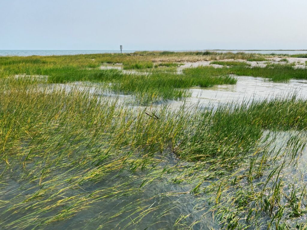
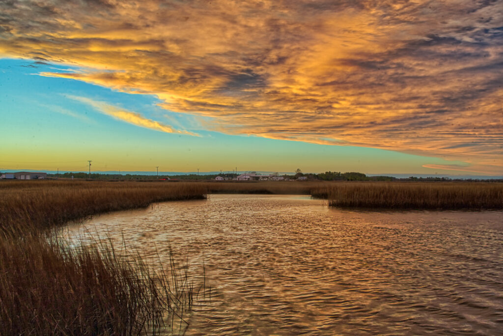
One of the best ways to experience the Bay landscape and its wildlife, is in a small boat. Paddlers can get up close to explore the salt marshes in the lower Bay on a 5-mile paddling loop around Cow Island in Virginia’s Big Salt Marsh near Poquoson.
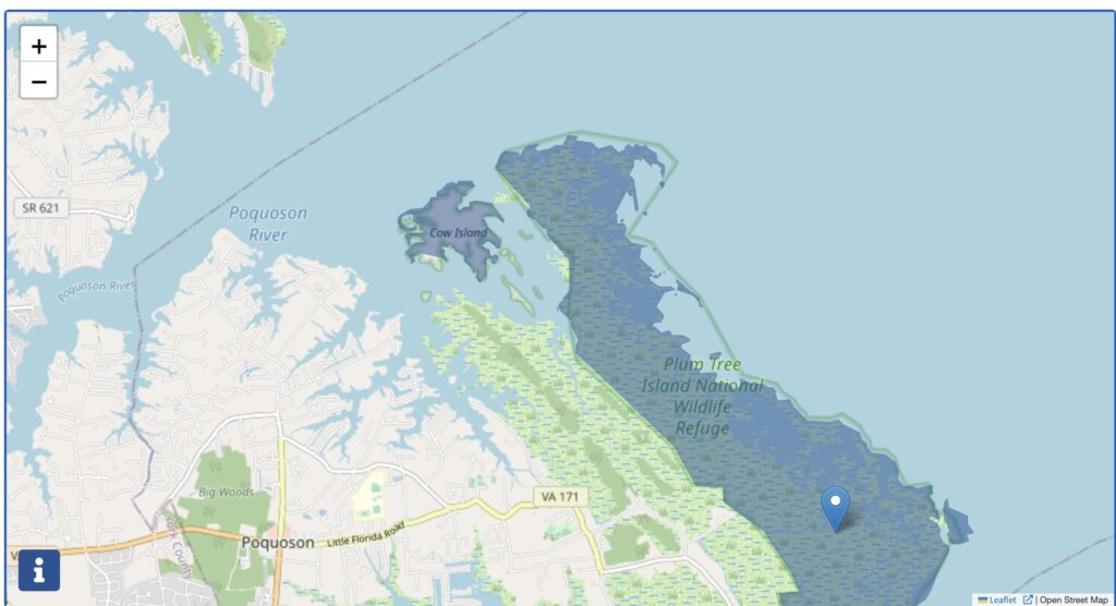
At 5 miles long and just over 2 miles across at its widest point, this is the largest salt marsh on the Chesapeake’s western shore, lying between the Poquoson River to the north and Back River to the south. Cow Island is part of the U.S. Fish and Wildlife Service’s Plum Tree Island National Wildlife Refuge.
Poquoson is the Algonkian word for great marsh. Counterintuitively, the thoroughly wild marsh lies within the incorporated City of Poquoson, on the northeast corner of the densely developed Hampton-Newport News metropolitan area on the Virginia peninsula, just across Back River from NASA’s Langley Research Center. The marsh previously belonged to the U.S. Department of Defense, which used it as a bombing range for Langley’s Air Force Base.
For much of the 20th century, few people thought salt marshes had value. By 1972, science and public opinion had swung strongly enough to spur Virginia’s General Assembly to pass the Commonwealth’s legislation protecting tidal wetlands.
This brings us back to Cow Island. It somehow escaped the base’s target practice. At 200 acres, it lies at the refuge’s northwest corner, and its name reflects one important value the early English residents of Poquoson saw in the marshes. From Christopher Calthrope’s land grant here in 1631 until the mid-20th century, farmers have grazed their cattle on the Big Marsh’s lush grasses. Though they took opprobrium at the name early on, the locals are now proud to call themselves “Bull Islanders”.
Note that public access is closed to all of the Plum Tree Island Refuge, including Cow Island, because of unexploded bombs from its earlier history and to protect nesting birds, especially in early summer.
It’s a good idea to scout a trip to Cow Island ahead of time using Google Earth and a navigation chart of your choice. Also, check the weather, as this loop is open to the wind from all directions. Make sure conditions for your day are within the limits of your paddling skills.
There is a free launch at the end of Rens Road in Poquoson within Whitehouse Cove Marina. There is also a fishing pier but limited parking. Download the city’s two-page Poquoson Blueway Map of Kayak & Canoe Trails for directions.
The route for the Cow Island circumnavigation begins with paddling east out of Whitehouse Cove into Bennetts Creek and around Marsh Island into Lloyds Bay. Turn left (north) into the slot just west of Sheep and Blacksnake islands and then into the narrow channel between Cow Island and the main part of the Big Marsh. This short channel leads to Sandy Bay, a lovely, shallow pocket that should be alive now with shorebirds, small fish, and crabs. It is both legal and safe to wade here, but remember that the marsh is off-limits above the mean low water line. Sandy Bay is a good place to get out and stretch your legs, but wear protective water shoes. Take time to look for birds like willets and oystercatchers, which nest in the marsh.
Paddle through the opening on the north side of Sandy Bay into the open Poquoson River and turn left (west) around Cow Island to head back to the launch ramp. If fishing is on your mind, you may want to try your luck along this section of the route. The shallow water generally has solid patches of underwater bay grasses that hold speckled trout, redfish, and other game fish. A jig under a rattle float, a gold weedless spoon, or a weedless Clouser Minnow will usually attract them. A good source of information is the Submerged Aquatic Vegetation Monitoring & Restoration Program at the Virginia Institute of Marine Science. The program surveys the entire Chesapeake tidal system each year and publishes an Interactive SAV Map that will allow you to zero in on last year’s survey for this area (and anywhere else in the Bay system of interest to you). For anglers, the SAV map is an invaluable tool. Strong local tackle shops include Bishop Fishing Supply and Grafton Fishing Supply.
Whether you fish or not, paddle back into Bennetts Creek to return to Whitehouse Cove and the Rens Road landing. After you load up your boat(s), consider a meal at the marina’s Surfrider Restaurant, which specializes in local seafood. If seafood is a motivator, be sure to visit Poquoson in October when it hosts the annual seafood festival. For more information, visit www.poquoson.com.