Virginia’s Historic Triangle—composed of Jamestown, Yorktown, and Williamsburg—is a magnet destination for visitors thanks to its carefully curated archaeology, authentic living history by committed reenactors and full-sized replicas of the ships that brought the first colonists to Jamestown.
Sitting just across the James River, hiding in plain sight, is a place where you can create your own living history experience. Better yet, you can only reach it by ferry. Even better, there’s a free VDOT car ferry to give you a scenic twenty-minute ride across the big river. The ferry ride is free, even if you’re towing an outboard skiff, or you have a canoe, kayak, or paddleboard strapped to your vehicle’s roof (and we recommend you do, for a full sightseeing experience!).
The vessel you’d ride would be either the Pocahontas, Powhatan, Surry, or Williamsburg, one of the four ferries in the Virginia Department of Transportation’s Scotland-Jamestown Fleet.
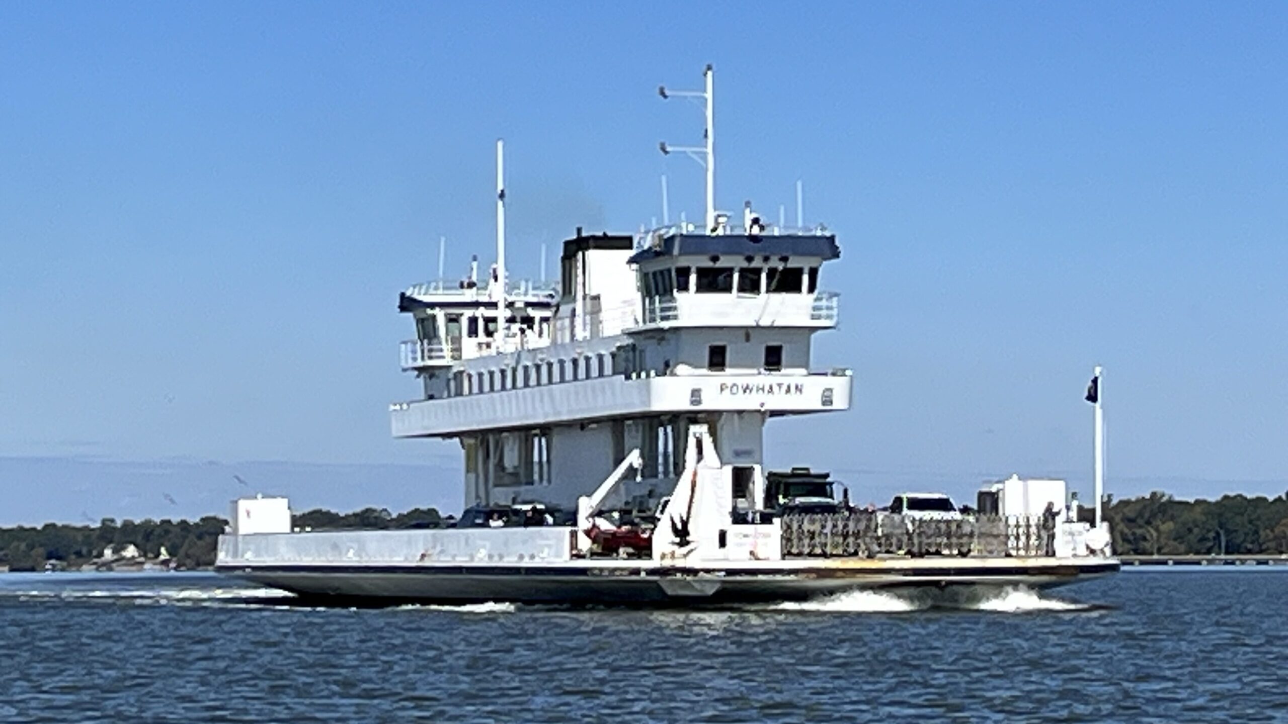
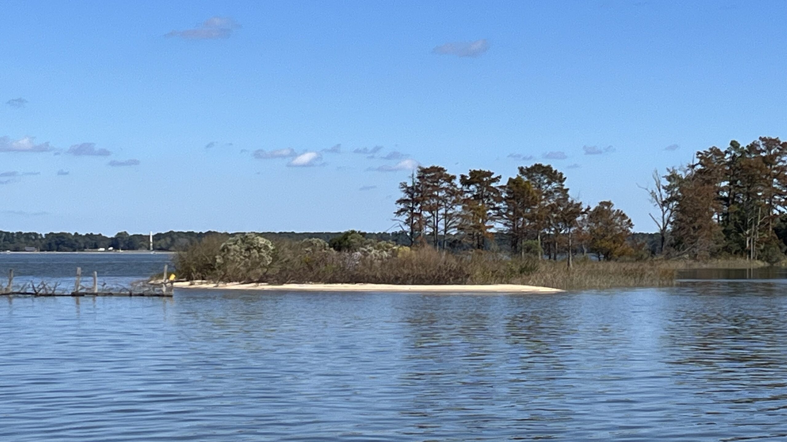
On the 15-minute, three-mile crossing, the ferry offers miles-long views up and down the river. The views are essentially the same as what the first English colonists saw in 1607 when they chose to settle at Jamestown. Upon arrival, the ferries dock on the south bank at Scotland Wharf in Surry County. In the tradition of the Algonkian Indians who lived here for centuries, the English considered the river as connecting its two sides, rather than separating them, so it’s no surprise to find that ferries have operated in this vicinity since 1660.
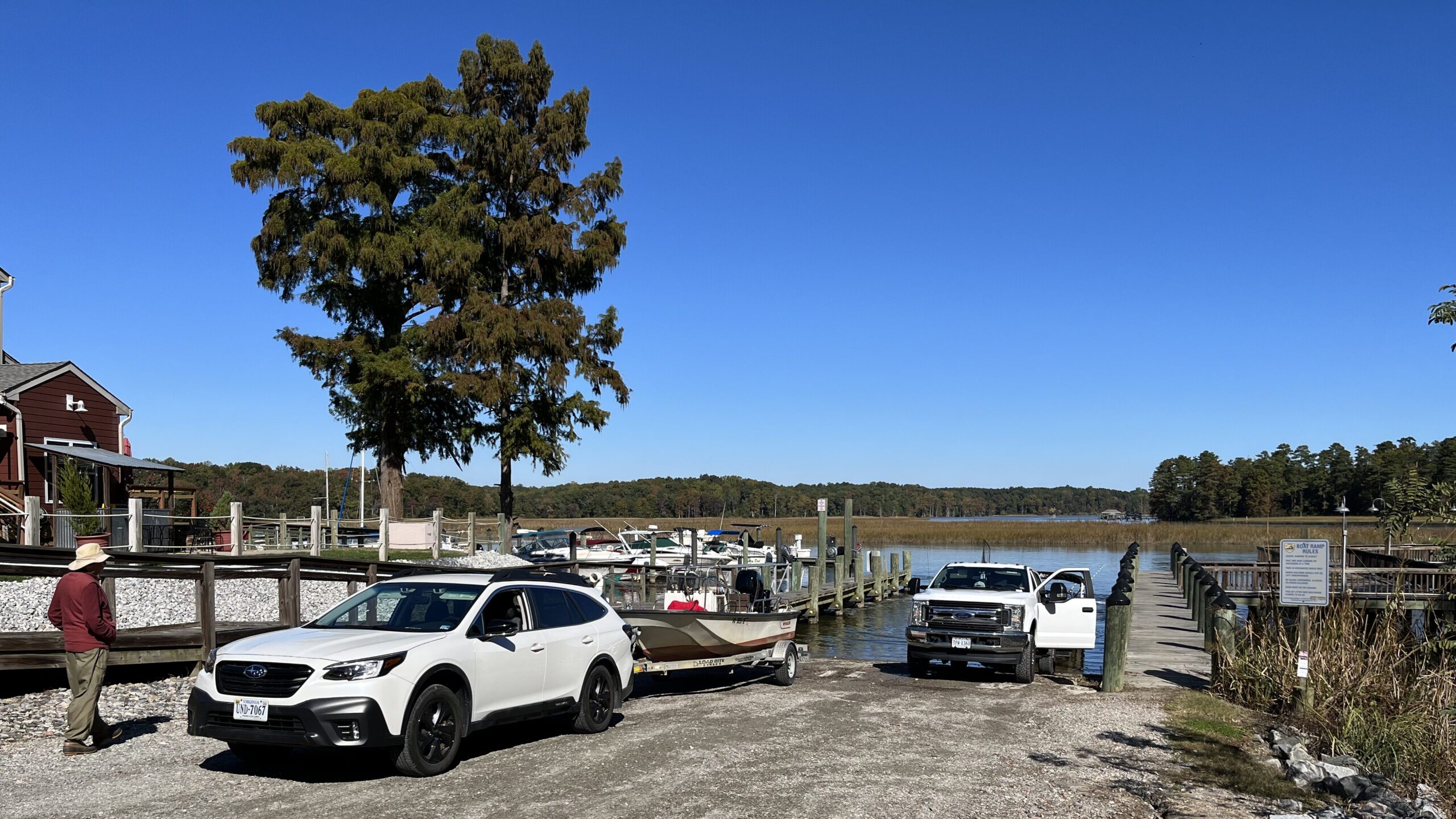
To get even closer to what made this country so valuable to both the Native Americans and the English, it’s important to get on the water in a small boat. From the ferry terminal, drive a mile-and-a-half south on Route 31 and turn right onto Marina Drive. At the end, you’ll find Gray’s Creek, a tidal gem with state Scenic River status. It has been a treasure to us humans for at least a millennium.
Gray’s Creek Landing offers a free, two-lane launch ramp operated by Virginia’s Department of Wildlife Resources (DWR) near the Surry Seafood Company’s Restaurant, Hotel, and Marina. Don’t let the name mislead you to think it’s too busy; this is a country seafood restaurant with four hotel rooms on the second floor and 45 boat slips on floating docks just inside the mouth of the creek. By all means, make it your base of operations, even if you haven’t brought your own boat. The Surry County Parks and Recreation Department offers kayak rentals and tours in the summer and fall.
Prior to 1607, Native people would have found the creek and its tributaries rich in spring with yellow perch, white (stiffback/gray) perch, river herring (alewives and bluebacks), and hickory shad. The main river would have swelled with American shad, rockfish, and Atlantic sturgeon. Today, the creek also holds largemouth bass, black crappie, and blue catfish (more on that fishery in our feature story here.)
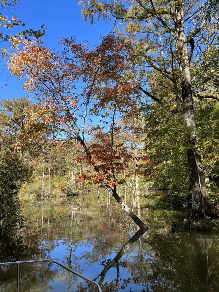
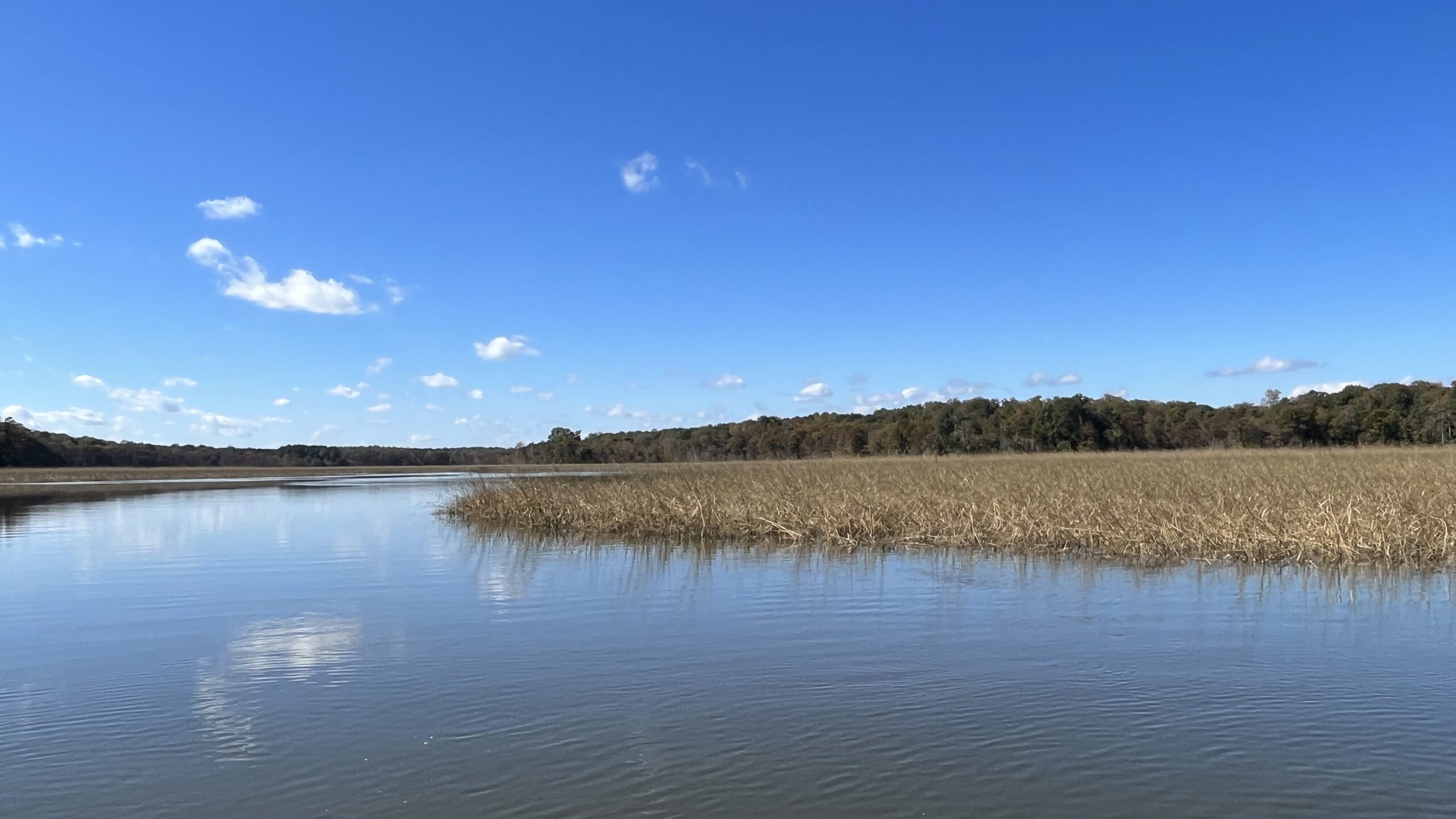
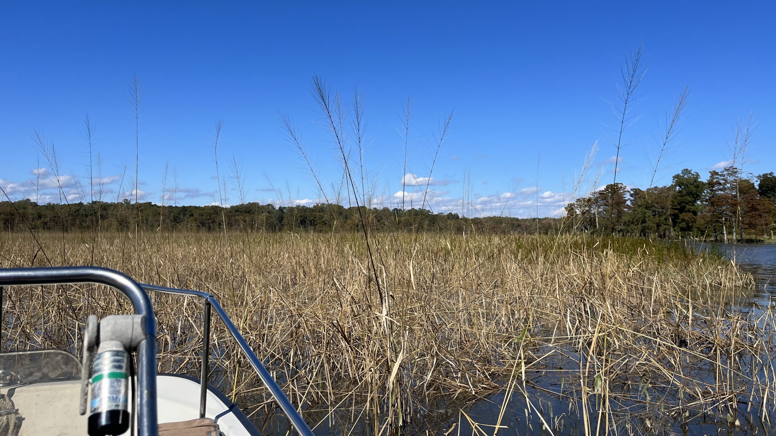
The origin of Gray’s Creek is Dark Swamp, a sprawling forested wetland that forms an effective filter, valuable for water quality despite its spooky name. As Gray’s Creek meets sea level, its freshwater forested/shrub wetland turns to tidal fresh marsh. Rimmed by bald cypress trees, the creek channel flows six miles to the James, though as the osprey flies, the distance point-to-point is just three miles.
For the Native people who lived here before the English came, the firm land on the outsides of the creek’s turns were perfect for villages, farm fields, and woods for hunting deer and turkeys. The marshes on the inside turns offered edible plants for foraging and waterfowl and furbearers for trapping. Freshwater springs flowed from the creek’s headwaters and high banks.
Near the mouth, the creek turns brackish. It comes by its Scenic River designation honestly, with wide buffers along its forested shorelines, acres of wild rice and other seed-bearing tidal fresh plants, and numerous side branches to explore, especially in paddlecraft. On a visit last fall, a friend and I explored all the way up to the head of tide in my 17’ Boston Whaler, but the marsh guts and side creeks make Gray’s a great waterway for exploring by canoe, kayak, or paddleboard.
English settlement along Gray’s Creek began in the summer of 1609 when Capt. John Smith ordered the building of a defensive fortification called the “New Fort” (marked on Smith’s 1612 map) to guard against attacks. He planted a Maltese cross in the wooded swamp at the headwaters (which makes Gray’s part of the Captain John Smith Chesapeake National Historic Trail). The fort was never completed (Smith left Virginia that fall), but its earthworks remain visible high on the eastern bank overlooking Gray’s Creek.
Five years later, the land became part of Chief Powhatan’s dowry given for his daughter Pocahontas’s marriage to John Rolfe in 1614. It was the site of a 1622 Native American rebellion to rid their lands of the English. One young Native warned an Englishman who lived on the creek, Richard Pace, of the impending massacre. The ambush killed more than 300 colonists up and down the James, but Pace crossed the James just in time to alert the people at Jamestown, saving many English lives.
By 1639, Gray’s Creek had taken its current name from Thomas Gray, who had patented land at the mouth. In 1652, the House of Burgesses separated the south bank land from James City County to become the English shire of Surry, the name we know today. It grew into a port with a network of streets including houses, stores, taverns, riverfront tobacco warehouses, and a wharf, though you wouldn’t guess it paddling along the banks today. It died out in the late 19th century.
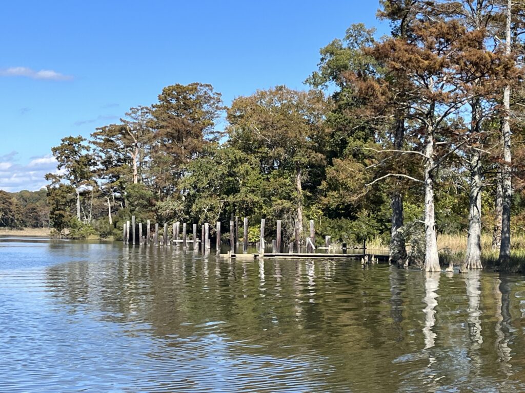
The deep channel in Gray’s Creek has always been valuable for transportation, including for shipping lumber, tobacco, and other crops like peanuts, corn, and cotton. In 1761, merchant Jacob Faulcon built a brick manor house on the Smith’s Fort land. In 1886, a collective group of Black families purchased the house and 521-acre farm around Smith’s Fort, and they prospered there (see photo of the remnants of the farm’s wharf). In 1928, they sold the farm and the brick merchant’s house to Colonial Williamsburg and started a successful business in Richmond. Preservation Virginia received the deed to the house and 20 acres in 1933 and has cared for it ever since.
Despite its many iterations and uses over these hundreds of years, Gray’s Creek still looks largely the way it has for centuries. It’s a peaceful place for exploring, birding, fishing, and just plain drifting. After a visit to the established sites of the Historic Triangle, the other side of the river offers its own immersion course in the origins of our country.