By Karl Blankenship & Jeremy Cox, Bay Journal News Service
The persistent storms that pounded the mid-Atlantic region in late July could have lingering impacts on the Chesapeake Bay, though it will take weeks, if not months, of monitoring for scientists to fully assess the potential damage.
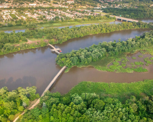
The deluge, which dumped 7 inches or more of rain on much of the Bay watershed over a five-day span beginning July 21, could be a temporary setback for Bay recovery efforts, where underwater grasses and dissolved oxygen levels have shown signs of recovery in recent years.
Large rainfall events generally have significant impacts on water quality because they wash more nutrients and sediment into the Bay and its rivers, where they cloud the water, spur algae blooms, bury bottom habitats and contribute to oxygen-starved “dead zones.”
The July rainfall was especially heavy in a band extending north and south along Maryland’s Western Shore into southern Pennsylvania. Storms dumped at least 10 inches of rain in the area, with one spot in Baltimore County receiving as much as 15 inches, according to the National Weather Service. BWI Marshall Airport got inundated with nearly 11.2 inches of rain. Norfolk, at the base of the Bay, received slightly more than 4 inches. Dulles Airport and the District of Columbia’s Northern Virginia suburbs got hit with 5 inches of rain on July 21 alone, fueling a total of 7.7 inches over those five soggy days.
The rain boosted flows on the Susquehanna River — which provides about half of the freshwater entering the Chesapeake — to about 400,000 cubic feet per second at the Conowingo Dam, according to the U.S. Geological Survey. The river hits that level, on average, about every five years but hasn’t peaked at that number since 2011.
That flow was far above the average July rate of 38,800 cfs for the river.
The gates on Conowingo Dam were opened to release the rising water, and Maryland issued voluntary evacuation orders for the Cecil County town of Port Deposit, about 6 miles downstream of the dam.
The timing of the recent rain event — during a typically dry midsummer month — is unusual.
Very high stream flows are usually associated with spring rains and snowmelt and with tropical storms and hurricanes that occur in late summer or fall. (But Tropical Storm Agnes, the most severe storm in recent decades, hit in June.)
High flows in the summer can be more damaging than at other times because it’s the peak of biological activity for many important Bay species, from underwater grass beds to juvenile fish and crabs.
Indeed, a recent report from the U.S. Army Corps of Engineers and the Maryland Department of the Environment examined the impact of high flow events from the Susquehanna River on the Chesapeake during similar storms in January, June and October.
The June storm, it found, had “greater adverse impacts to water quality, habitat, and living resources than October and January events.”
Potential impacts of freshwater surging into the Bay include the following:
- Large freshwater flows can lead to long periods of low-salinity water that cause oyster diebacks, particularly in the Upper Bay.
- Sediment associated with high flows can bury oyster reefs and bottom-dwelling organisms.
- Sediment and nutrient-fueled algae blooms block sunlight from reaching underwater grasses, which could cause diebacks of grass beds whose acreages hit record highs last year.
- Nutrients accompanying the flows could fuel expanded algae blooms during the second half of the summer.
- Oxygen-starved “dead zones” in deep areas of the Bay could worsen as that algae die, sink to the bottom and are decomposed by bacteria in a process that depletes the water of oxygen.
- In some places, high flows could flush juvenile fish out of optimal nursery habitats.