I step aboard the long, white workboat and examine my surroundings. A rusty dredge, worn tables, handmade tools, an abundance of muddy buckets and a huge steel pot. I’m handed orange rubber gloves and a lived-in vinyl apron that grazes my sneakers. It’s then that I realize things are about to get messy.
Although it’s just another workday for my hosts—a handful of shellfish scientists and researchers from the Maryland Department of Natural Resources—I’m excited to experience Maryland’s Fall Oyster Survey firsthand, and happy to trade the office for a scenic boat ride on an unseasonably warm November day.
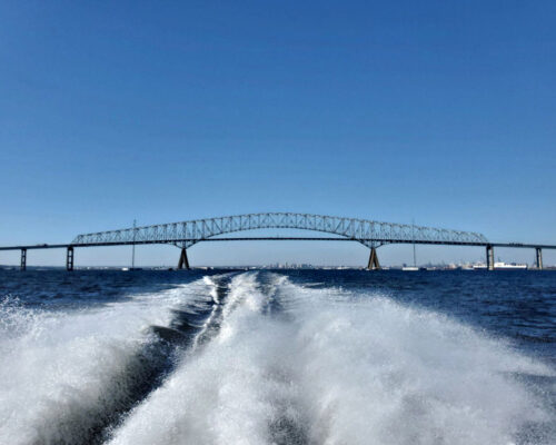
We’re aboard the Miss Kay, the state’s 48-foot research vessel, under the watchful eyes of longtime captain David White. Typically docked on Deal Island in Tangier Sound and used for projects as needed, the boat puts in overtime October through November during Maryland’s Fall Oyster Survey.
Through the annual monitoring effort, state fisheries staff visit about 260 oyster reefs, or bars, throughout the Chesapeake Bay and its tributaries to track the status and trends of Maryland’s oyster population. They count, measure and examine oysters to gauge abundance, reproduction levels, mortality rates, and possible disease presence. Mind you, this is no new undertaking. Maryland’s oyster survey dates back 78 years, and is believed to be the longest running program of its kind in the world.
All aboard and geared up, we vacate our slip at Piney Narrows Marina in Chester and set out to the upper Bay to sample 21 oyster bars between the Bay Bridge and Pooles Island. First on the list is Love Point bar at the northernmost tip of Kent Island.

Once the GPS signals we’ve reached our destination, Mitch Tarnowski, a state shellfish biologist, jumps into action to deploy the vessel’s oyster dredge. The chain-link-basket is dragged a few hundred feet along the Bay’s bottom and raised to reveal a large pile of glossy, brown oyster clusters.
Tarnowski looks at the basket in approval, “This one’s beautiful,” he calls to Captain White, letting him know we don’t need another run through. He informs me that getting a nice sample on the first try can be difficult. “One time we got tangled in a massive cable on our final bar of the day,” he says. “Every sample collected quickly and easily is seen as a minor triumph.”
Once the material is dumped on the culling table, I join two others to quickly measure and sort the oysters into groups based on size. We then count the number of oysters in each size group, which helps determine reproductive success and the overall health of an oyster bar. For example, a bar with lots of baby oysters, or spat, would suggest recent spawning success. Depending on the site, each sample may contain oysters of different ages, shapes, sizes, textures, growth patterns and spat set. Many of these characteristics can be attributed to varying water quality, flow, salinity, and bottom habitat, as well as reproduction and disease levels.
Another step in the survey includes recording what types of marine life are on the oyster bars. Hidden among the shellfish we find mud crabs, oyster toadfish and tunicates or “sea squirts,” which are small orb-shaped, translucent creatures. The toadfish, with its grumpy expression, mouth full of tiny teeth, and affinity for hiding in vacant shells, is the most interesting to me. After some coaxing, one latches onto my gloved finger before back-flipping off the boat.
We continue the process of measuring, sorting and counting at the next 20 oyster bars, enjoying the sights along the way. We pass by the historic Craighill Channel Lower Front Range Light, located about two miles southeast of North Point, the Baltimore Harbor Light at the mouth of the Magothy River, and the Sandy Point Shoal Lighthouse, just north of the Chesapeake Bay Bridge.
We pull into our slip signaling the end of our eight-hour journey. I say good-bye to my new friends and hand over my mucky apron and soggy gloves (checkbox messy).
After my outing, the daily surveys continue, but the beautiful weather does not. Temperatures drop, it rains for days and we lose an hour to daylight savings time. Of course this turn of events makes me appreciate my pleasant experience, but I’m even more appreciative of those who work day in and day out on behalf of our Bay, in all kinds of weather to assess and enhance its resources and the lives of all of us who enjoy it.
—Karis King
Karis King is the Event and Outreach Manager for the Oyster Recovery Partnership. Learn more at www.oysterrecovery.org.
Oyster Surveys Around the Bay
Maryland and Virginia have monitored oyster population trends since the late 1930s and
early 1940s.
The primary Maryland survey collects more than 320 samples from Maryland and Potomac River oyster bars to assess oyster health, population density and evidence of successful reproduction (recruitment). The reports are posted at dnr.maryland.gov/fisheries/Pages/oysters.
Much like Maryland’s Fall Survey, the Virginia Dredge Survey monitors about 243,000 acres of historic oyster bars to assess oyster growth, mortality and recruitment. Virginia also conducts a patent tong survey on more than 800 tributary stations to provide estimates of the standing stock. The Virginia survey results are available at www.vims.edu.