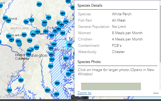
The Maryland Department of the Environment (MDE) has launched an interactive map to help you find out if your catch is safe to eat, and it’s as easy as a few clicks on your smartphone or computer.
A screenshot of the fish advisory map in action.The MDE tests recreationally caught fish and crab from across the state (24 species from almost 90 areas of water, to be exact) for polychlorinated biphenyls (PCBs) and methylmercury, contaminants thought to cause serious health problems in humans.
Once the results are plugged into an equation, the MDE is able to create a consumption advisory, or, a recommendation for how many meals of a specific fish caught in a specific area should be eaten.
The MDE says that in addition to providing important information to anglers and the general public, the test results also reflect levels of environmental pollution, since contaminants accumulate over time in the species that are sampled.
The clickable map can be used on mobile phones or computers. It allows users to zoom in on specific waterways and see if any advisories exist in the area. Users can also easily share results and data.
MDE Secretary Ben Grumbles on the advisory map: “We encourage anglers to take advantage of the new map and the health-based meal recommendations for fish and crabs to make smart decisions.”
To check out the new map, click here.
-Laura Boycourt


